Anders Bure
Swedish politician (1571-1646) · Sweden · On the map · Scientists · Died at 74
Anders Bure was a Swedish cartographer, considered the "father of Swedish cartography". He worked in the royal chancery and in 1603 was commissioned to produce a map of the Nordic countries by the future King Charles IX of Sweden.
Anders Bure is read about 6 times a day, in 5 languages.
A typical day, 30 days to 23 June 2026
The middle day of the days counted, so one week of news cannot move it. The line under it is the last 60 days, one point a day.
Something wrong?Media & music
Photos 4
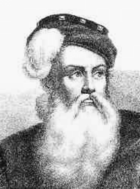
 One of only two preserved originals of Lapponia from 1611. From Uppsala University Library, previously in Trolleholm Castle.[13]
 Bure's 1626 map of Scandinavia, from the collections of the National Library of Sweden. A total of seven copies of the original print run are known to have survived.[15]
 One of the six separate sheets that make up Bure's map of Scandinavia, in a hand-coloured version.
About this person
He produced a first map, covering the northern parts of Sweden, in 1611; it was considerably more accurate than earlier attempts at mapmaking and has been called the first real map of Sweden. It was followed by a more comprehensive map of Scandinavia in 1626, which would become a model for mapmakers for generations. In 1628, he became de facto the first head of Lantmäteriet, the Swedish Mapping, Cadastral, and Land Registration Authority. The instructions he produced for the agency's work were in force for over two centuries. He was ennobled in 1624.


